Of Interest to the Volcanophile
Here are some interesting links to information about volcanoes.
Yellowstone and the Yellowstone Volcano Observatory (YVO)
- Hot off the press! The Yellowstone Volcano Observatory (YVO) has just released a new, highly useful information product—an annual report that covers calendar year 2017. This report, which can be accessed and downloaded at https://pubs.er.usgs.gov/publication/cir1456, will later be followed by annual reports for 2018 and 2019. These annual reports summarize earthquake and ground-deformation activity, as well as results of many other studies conducted by YVO during the year (e.g., monitoring of water and gas chemistry, geyser eruptions, and investigations of past lava eruptions).
- In January 2018, the Yellowstone Volcano Observatory (YVO) inaugurated a new feature/link on its website called the “Yellowstone Caldera Chronicles.” Click here to see this new link.
- YVO’s new link is analogous to, and inspired by, the highly popular weekly column, called “Volcano Watch” , written by scientists and affiliates of the Hawaiian Volcano Observatory (HVO). Click here to access Volcano Watch.
- A six-day field trip to the Yellowstone thermal area. Field Guide Morgan, L.A., Shanks, W.C.P., Lowenstern, J.B., Farrell, J.M., and Robinson, J.E., 2017, Geologic field-trip guide to the volcanic and hydrothermal landscape of the Yellowstone Plateau: U.S. Geological Survey Scientific Investigations Report 2017–5022–P, 100 p.
Kilauea Eruptions 2018
-
Hawaiian Volcano Observatory: <https://volcanoes.usgs.gov/
observatories/hvo/>. -
Big Island Video News: <http://www.bigislandvideonews.com/>
-
Hawaii News Now: <http://www.hawaiinewsnow.com/>
Kilauea Volcano
- Why is Kilauea Volcano (Hawaii) ranked as no. 1 volcanic threat in the U.S., and Yellowstone caldera is ranked as no. 21? Check out this new USGS publication to learn the reasons why. Also, you can find the relative threat rankings for any of your other favorite U.S. volcanoes.
- Hot off the press! The best summary published to date of the 2018 eruption of Kilauea Volcano— the largest, and most destructive, in its lower East Rift Zone eruption in at least 200 years. READ
- In 2017 the USGS published its latest general-interest product (GIP) titled “Kilauea Summit Eruption/Lava Returns to Halema’uma’u.” This 24 minute video has fabulous shots of an active volcano YouTube Link.
Other Interesting Links
- A “Geonarrative” titled “Volcanic Landscapes”
- “Field-trip guides to selected volcanoes and volcanic landscapes of the western United States”: USGS Scientific Investigations Report 2017-5022,”
- Global Volcanism Program (GVP) of the Smithsonian Institute: https://volcano.si.edu/“
- This Dynamic Planet: World Map of Volcanoes, Earthquakes, Impact Craters, and Plate Tectonics”) a joint project of the USGS and the Smithsonian (See <https://pubs.usgs.gov/imap/2800>).

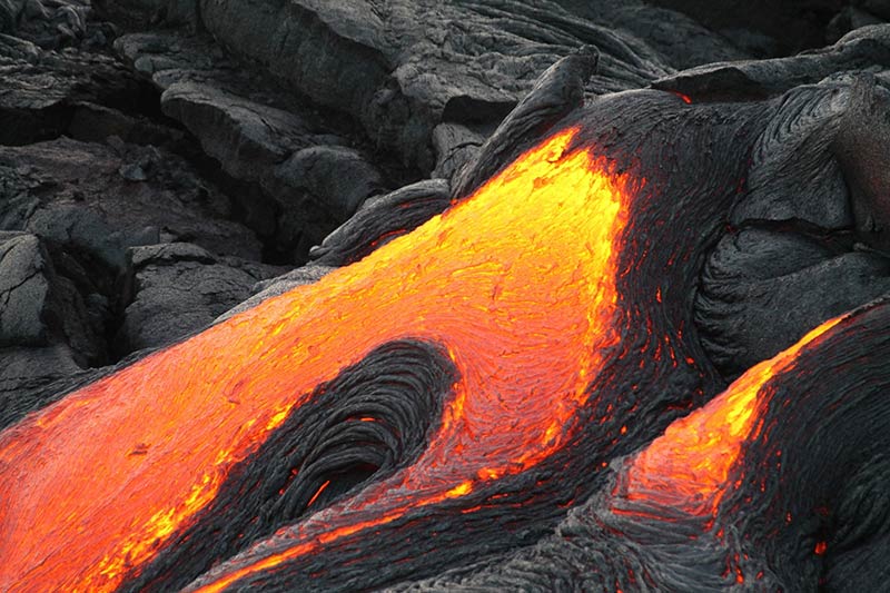
Early evening view of the lava lake within Halema‘uma‘u crater at the summit of Kīlauea Volcano on January 30, 2018, when the lake level was 27 m (88 ft) below the crater floor. The bright yellow area of spattering marks the location where the circulating lava descends into the lake, thereby releasing gases trapped beneath the solid black crust on the lake surface. The area around Halema‘uma‘u remains closed due to ongoing volcanic hazards associated with the lava lake, including high levels of sulfur dioxide gas and unexpected rockfalls and explosions. USGS photo by M. Patrick.
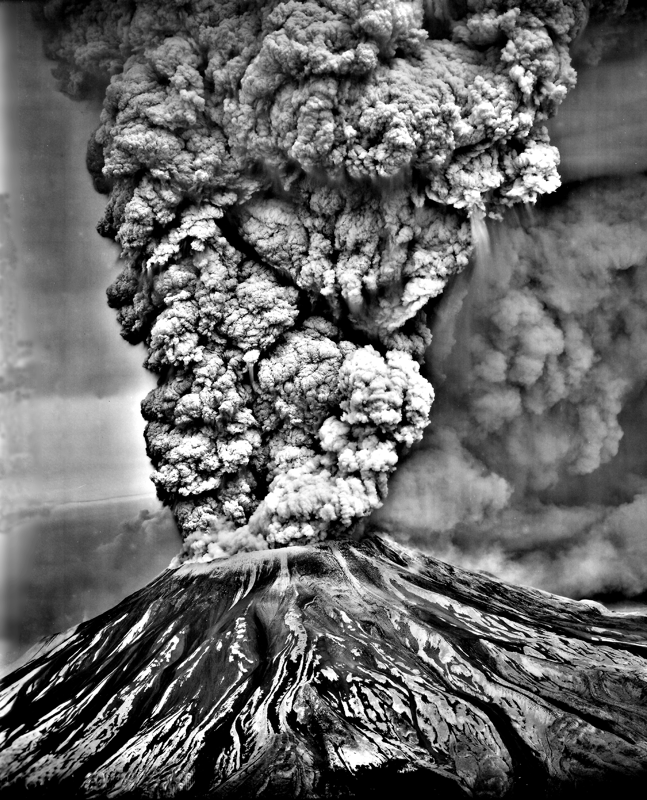
Mount St. Helens May 18 1980
US Volcanoes Information and Resources for Kids
Here is a link of interest to kids interested in Volcanoes.